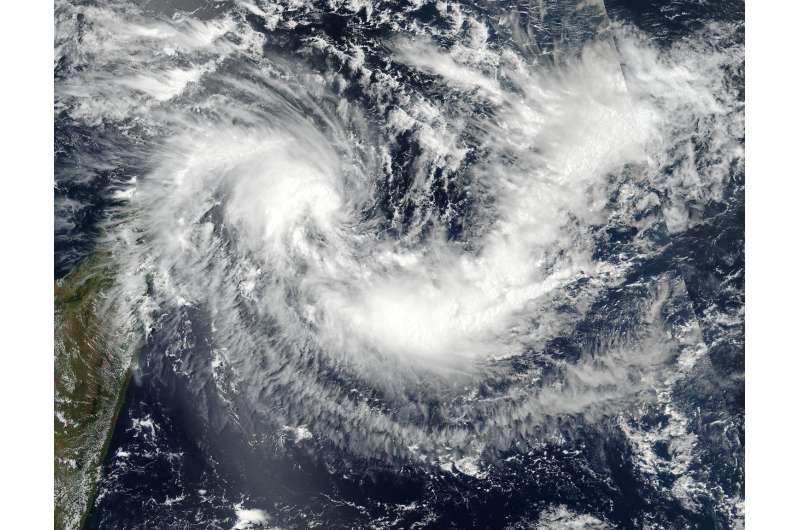
Suomi NPP satellite sees formation of Tropical Storm Enawo

Tropical Storm Enawo formed in the Southern Indian Ocean, just northeast of the island nation of Madagascar as NASA-NOAA's Suomi NPP satellite passed overhead and captured an image of the storm. Warnings are already in effect for the eastern part of the country.
On March 3 at 0954 UTC (4:45 a.m. EST) the Visible Infrared Imaging Radiometer Suite (VIIRS) instrument aboard the NASA-NOAA Suomi NPP satellite captured a visible image of Enawo. Enawo is the ninth tropical cyclone to form in the Southern Indian Ocean this season. The VIIRS image showed a concentration of thunderstorms around the center of circulation and a large area of storms in the northwestern quadrant.
At 0900 UTC (4 a.m. EST) on March 3, the Joint Typhoon Warning Center or JTWC issued their first warning on Enawo. At that time, Enawo was located near 12.7 degrees south latitude and 56.8 degrees east longitude, about 445 nautical miles (512 miles/ 924 km) north of Port Louis, Mauritius. Enawo was moving to the west-southwest at 10 knots (11.5 mph/18.5 kph) had maximum sustained winds near 35 knots (40 mph/62 kph).
The Madagascar Meteorological Services or MMS has issued a warning for coastal areas from the northeast to the eastern parts of the country as Enawo is forecast to track along the east coast while remaining at sea. After 3 to 4 days, JTWC forecasts the storm to strengthen to hurricane-strength as it approaches the east coast of Madagascar.
Provided by NASA's Goddard Space Flight Center


