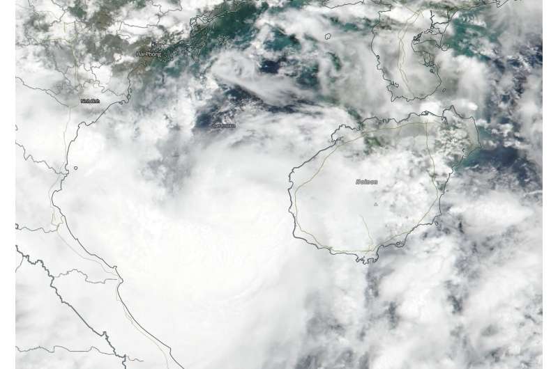
Suomi NPP satellite sees compact storm Son-Tinh Headed for Vietnam

NASA-NOAA's Suomi NPP satellite flew over Tropical Storm Son-Tinh on July 18 after it crossed over Hainan Island, China and as it moved into the Gulf of Tonkin.
The Visible Infrared Imaging Radiometer Suite (VIIRS) instrument aboard NASA-NOAA's Suomi NPP satellite captured a visible image that showed a compact system with a small area of deep and persistent convection.
At 5 a.m. EDT (0900 UTC) the Joint Typhoon Warning Center (JTWC) reported the center of Tropical Storm Son-Tinh was located near latitude 19.0 degrees north and longitude 107.4 degrees east. That's about 173 nautical miles southeast of Hanoi, Vietnam. Son-Tinh was moving to the west. Maximum sustained winds were near 46 mph (40 knots/74 kph).
The JTWC forecasts that Son-Tinh will continue to track westward along the southwestern edge of a subtropical ridge (elongated area) of high pressure. Despite unfavorable vertical wind shear the storm will track through warm sea surface temperatures and slowly weaken.
JTWC expects Son-Tinh will make landfall in northern Vietnam shortly later on July 18 (EDT) and then continue to track inland and dissipate by July 20.
Provided by NASA's Goddard Space Flight Center


