December 20, 2022 report
Power plants found likely to be in close proximity to neighborhoods classified as 'hazardous' by HOLC redlining

Bob Yirka
news contributor

A group of researchers from the University of California Los Angeles and the Columbia Mailman School of Public Health has found that fossil fuel plants are more likely to be found near to neighborhoods identified as hazardous during HOLC redlining.
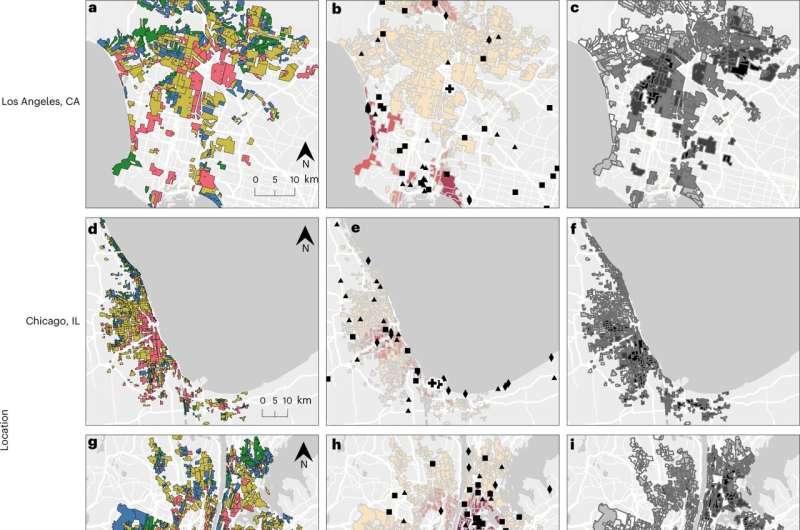
In their paper published in the journal Nature Energy, Lara Cushing, Shiwen Li, Benjamin Steiger and Joan Casey describe how they looked at old maps of several major American cities and compared them with weather patterns in the same areas over three major time periods: 1940 to 1969, 1970 to 1999 and 2000 to 2020.
Jonathan Levy with the Boston University School of Public Health, has published a News & Views piece in the same journal issue outlining the history of structural racism in the U.S. over the past century and discusses the work by the team on this new effort.
Prior research has shown that people living in the poor parts of cities tend to be exposed to more pollutants, resulting in more health problems than people living in more affluent areas. Complicating the issue is the fact that the majority of people living in such areas are minorities. In this new effort, the researchers looked at one of the impacts of redlining on certain urban areas.
In the 1930s, an organization called the Home Owners Loan Corporation (HOLC) was established. Its charter was to assist banks and other loan companies by assessing risk associated with home loan payments. As part of their work, the HOLC created colorized maps of cities labeled with different colors. The wealthy, upscale parts of town were colored green, while the poorest sections of town were labeled red. People buying in green districts found it easy get loans while those wanting to buy in red areas found it nearly impossible. This made it difficult for people already living in such areas to sell their houses, which led to the term "redlining."
In this new effort, the researchers wondered if the placement of power plants and freeways during the days of the HOLC, which was shut down in the 1950s, might have been impacted by the HOLC maps. To find out, they studied historical maps of several major metropolitan areas, comparing placement of fossil fuel plants with redlined districts. They also noted historical weather pattern flow to determine which way the pollution from such plants blew.
They found that such plants were more likely to be located in or near redlined districts, particularly after the Second World War—though they also found that such placement declined in the years after the war. They also found that redlining could be associated with exposure to higher levels of nitrogen oxide, sulfur dioxide and particulate matter. They conclude that persistence has led to higher levels of such pollution in previously redlined districts all the way up to today.
Written for you by our author —this article is the result of careful human work. We rely on readers like you to keep independent science journalism alive. If this reporting matters to you, please consider a (especially monthly). You'll get an ad-free account as a thank-you.
More information: Lara J. Cushing et al, Historical red-lining is associated with fossil fuel power plant siting and present-day inequalities in air pollutant emissions, Nature Energy (2022).
Jonathan I. Levy, Redlining and power plant siting, Nature Energy (2022).
Journal information: Nature Energy
© 2022 Science X Network


