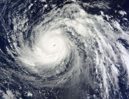
NASA eyes Super-typhoon Lekima in the northwestern Pacific

NASA's Terra satellite flew over Lekima after it became a super-typhoon in the northwestern Pacific Ocean and captured visible and infrared data on the storm.
Early on Oct. 23 at 00:25 UTC/Oct. 22 at 8:25 p.m. EDT, the Moderate Resolution Imaging Spectroradiometer instrument that flies aboard NASA's Terra satellite was busy capturing data on Lekima. The MODIS image clearly showed Lekima's 20 nautical mile/23 mile/37 km-wide-eye with bands of thunderstorms wrapping tightly into the center of circulation.
On Oct. 23 at 11 a.m. EDT/1500 UTC, Lekima's powerful sustained winds were near 140 knots/161.1 mph/259.3 kph. Typhoon-force winds extended 55 nautical miles/63.2 miles/101.9 km from the center, while tropical storm force winds extended 125 nautical miles/143.8 miles/231.5 km from the center. Lekima's eye was located near 19.7 north latitude and 149.2 east longitude, about 443 nautical miles/509 miles/820.4 km northeast of Andersen Air Force Base, Guam. Lekima was moving to the west-northwest at 11 knots/12.6 mph/20.3 kph.
Lekima is expected to move northwest for the next day and a half before it is pushed to the north and then northeast from an approaching trough (elongated area of low pressure) moving toward it from the west.
Provided by NASA's Goddard Space Flight Center


