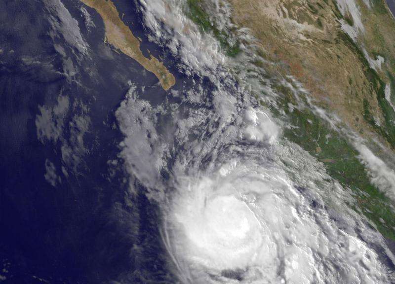
Satellites see Hurricane Dolores more organized

Hurricane Dolores appears more organized in satellite data today, July 14, and the cloud tops are colder, indicating that the storm is strengthening.
On July 14, imagery from NOAA's GOES-West satellite and NASA's Aqua satellite showed that Dolores cloud pattern became more organized since yesterday, July 13. The imagery showed a well-developed symmetric central dense overcast. Infrared data from the Atmospheric Infrared Sounder (AIRS) instrument that flies aboard NASA's Aqua satellite showed cloud top temperatures near -80 degrees Celsius/-112 Fahrenheit.
At 5 a.m. EDT (0900 UTC), the center of Hurricane Dolores was located near latitude 17.3 North, and longitude 107.5 West. That's about 245 miles (395 km) south-southwest of Cabo Corrientes, Mexico. There are no coastal watches or warnings in effect.
NOAA's National Hurricane Center (NHC) reported that Dolores was moving toward the west near 6 mph (9 kph) and a turn toward the west-northwest is expected later today, July 14. The storm is expected to move in a west-northwesterly direction through July 15. Maximum sustained winds have increased to near 80 mph (130 kph) with higher gusts. The estimated minimum central pressure is 984 millibars.
The NHC noted that as Dolores continues to pull away from the coast, additional rainfall amounts of up to an inch are possible along the southwestern coast of Mexico in the states of Colima and Jalisco. Dolores will continue generating rough surf along the southwestern coast of Mexico, and the rough surf is expected to affect the southern coast of the Baja California Peninsula later today.
The NHC expects Dolores to strengthen over the next two days and become major hurricane on July 15.
Provided by NASA's Goddard Space Flight Center


