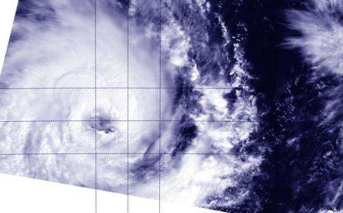
NASA sees Tropical Cyclone Bruce still wide-eyed

Tropical Cyclone Bruce was still maintaining hurricane-force in the Southern Indian Ocean when NASA's Terra satellite passed over the eye of the storm.
The Moderate Resolution Imaging Spectroradiometer instrument known as MODIS takes amazing visible and infrared images of tropical cyclones, among other things, and captured a good look into the eye of Bruce on Dec. 19 at 03:41 UTC. Although Bruce's eye seemed to have some high clouds, the eye was still visible. Also visible by MODIS were thick bands of thunderstorms wrapping around the storm's northern quadrant. Convection (rising air that forms the thunderstorms that make up a tropical cyclone) was seen strengthening around the eyewall.
On December 19 at 1500 UTC, Tropical Cyclone Bruce's maximum sustained winds were near 90 knots/103.6 mph/166.7 kph. Bruce was centered near 12.7 south and 90.7 east, about 330 nautical miles/379.8 miles/611.1 km west of Cocos Island, Australia. It was moving to the west-southwest at 10 knots/11.5 mph/18.5 kph.
Bruce is moving along the northern edge of an elongated area of subtropical high pressure and is expected to continue moving to the west-southwest for another three days according to the Joint Typhoon Warning Center.
Provided by NASA's Goddard Space Flight Center


